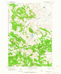
1962 Map of Middle Creek Lake
USGS Topo · Published 1964About this map
Helena National Forest dominates this high-elevation landscape, where the convergence of Cascade, Lewis and Clark, and Meagher counties creates a complex network of political and natural boundaries. The geography is defined by sharp topographic shifts from Shellrock Ridge to the peaks surrounding Moors Mountain. This 1962 survey reveals a remote backcountry infrastructure of seasonal outposts and specialized transit, notably Tyrell Camp and Wooden Shoe Camp.
Find a feature on this map
28 named features on this map. Tap any name to fly to it.
Don’t see what you’re looking for? This feature index may not catch every label — zoom into the map to look around manually.
Map Details
Editions of this 1962 Middle Creek Lake Map
2 editions found
Other maps of this area

1886 · Great Falls
USGS Topo · 1:250,000

1886 · Fort Logan
USGS Topo · 1:250,000

1948 · White Sulphur Springs
USGS Topo · 1:250,000

1954 · Great Falls
USGS Topo · 1:250,000

1957 · Great Falls
USGS Topo · 1:250,000

1958 · White Sulphur Springs
USGS Topo · 1:250,000

1961 · White Sulphur Springs
USGS Topo · 1:250,000

1961 · Hound Creek Reservoir
USGS Topo · 1:24,000

1961 · Dana Ranch
USGS Topo · 1:24,000
1961 · The Sawteeth
USGS Topo · 1:24,000