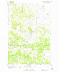
1962 Map of Middle Creek Lake
USGS Topo · Published 1978About this map
Middle Creek Lake sits at the center of this remote high-altitude landscape, where the Helena National Forest spans the border between Cascade, Lewis and Clark, and Meagher counties. The area is defined by the headwaters of the Middle Creek and Wickiup Creek systems, characterized by steep elevations rising toward the summit of Moors Mountain. This mid-century view documents a landscape primarily accessed via a network of Jeep Trails and Pack Trails, with a significant industrial footprint evidenced by the long Pipeline cutting across the mountain flanks. Local history is preserved in the names of primitive campsites and shelters, including Tyrell Camp, Wooden Shoe Camp, and the remote Hump Cabin near the southern boundary. These labels offer a detailed look at the seasonal human presence in these mountains before more modern recreational infrastructure was established.
Find a feature on this map
33 named features on this map. Tap any name to fly to it.
Don’t see what you’re looking for? This feature index may not catch every label — zoom into the map to look around manually.
Map Details
Editions of this 1962 Middle Creek Lake Map
2 editions found
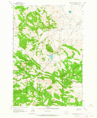
Other maps of this area

1886 · Great Falls
USGS Topo · 1:250,000

1886 · Fort Logan
USGS Topo · 1:250,000

1948 · White Sulphur Springs
USGS Topo · 1:250,000

1954 · Great Falls
USGS Topo · 1:250,000

1957 · Great Falls
USGS Topo · 1:250,000

1958 · White Sulphur Springs
USGS Topo · 1:250,000

1961 · White Sulphur Springs
USGS Topo · 1:250,000

1961 · Hound Creek Reservoir
USGS Topo · 1:24,000

1961 · Dana Ranch
USGS Topo · 1:24,000
1961 · The Sawteeth
USGS Topo · 1:24,000