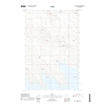
2020 Map of Middle Eighth Coulee
USGS Topo · Published 2020About this map
Fort Peck Lake dominates the southern portion of this landscape, its intricate shoreline forming deep inlets such as Eighth Coulee Bay. This corner of Valley County is defined by a repetitive system of ridges and coulees that drain toward the reservoir, reflecting a highly dissected terrain where water management is critical for local utility. Scattered upland water sources like Tiger Reservoir, Magruder Reservoir, and Stebley Reservoir are perched among the higher elevations, suggesting the importance of these catchments in a region where natural drainage is often intermittent. The topographic naming convention follows a sequential pattern, including Seventh Ridge and Sixth Ridge, while Graveyard Hill stands as a notable landmark overlooking the western reaches of the Upper Eighth Coulee.
Find a feature on this map
23 named features on this map. Tap any name to fly to it.
Don’t see what you’re looking for? This feature index may not catch every label — zoom into the map to look around manually.
Map Details
Editions of this 2020 Middle Eighth Coulee Map
This is the sole edition of this map. No revisions or reprints were ever made.
Other maps of this area

1954 · Jordan
USGS Topo · 1:250,000

1956 · Jordan
USGS Topo · 1:250,000

1958 · Jordan
USGS Topo · 1:250,000

1958 · Collins Ranch
USGS Topo · 1:62,500

1958 · Maloney Hill
USGS Topo · 1:62,500

1958 · Lewis Reservoir
USGS Topo · 1:24,000
1958 · Seventh Point Buttes
USGS Topo · 1:24,000

1964 · Jordan
USGS Topo · 1:250,000
1972 · Signal Butte
USGS Topo · 1:24,000

1978 · Fort Peck Lake East
USGS Topo · 1:100,000