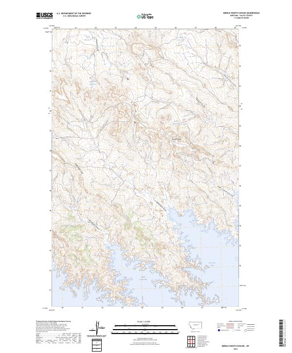
2024 Map of Middle Eighth Coulee
USGS Topo · Published 2024About this map
Charles M Russell National Wildlife Refuge dominates the southern portion of this landscape, where the broken plains meet the expansive waters of Fort Peck Lake. The map reveals a highly dissected terrain defined by a series of dramatic ridges and coulees, including Middle Eighth Ridge and Sixth Ridge, which channel water toward the reservoir system. Human intervention in this arid environment is evident through several small upland catchments like Magruder Reservoir, Tiger Reservoir, and Stebley Reservoir, likely serving livestock or wildlife in these remote grazing lands. The intricate shoreline of Eighth Coulee Bay illustrates the complex topography created when the Missouri River was impounded, flooding the lower reaches of drainage features such as Middle Eighth Coulee and Upper Eighth Coulee.
Find a feature on this map
22 named features on this map. Tap any name to fly to it.
Don’t see what you’re looking for? This feature index may not catch every label — zoom into the map to look around manually.
Map Details
Editions of this 2024 Middle Eighth Coulee Map
This is the sole edition of this map. No revisions or reprints were ever made.
Other maps of this area

1954 · Jordan
USGS Topo · 1:250,000

1956 · Jordan
USGS Topo · 1:250,000

1958 · Jordan
USGS Topo · 1:250,000

1958 · Collins Ranch
USGS Topo · 1:62,500

1958 · Maloney Hill
USGS Topo · 1:62,500

1958 · Lewis Reservoir
USGS Topo · 1:24,000
1958 · Seventh Point Buttes
USGS Topo · 1:24,000

1964 · Jordan
USGS Topo · 1:250,000
1972 · Signal Butte
USGS Topo · 1:24,000

1978 · Fort Peck Lake East
USGS Topo · 1:100,000