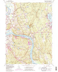
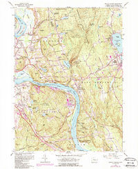
1961 Map of Middle Haddam
USGS Topo · Published 1988About this map
Connecticut River bends sharply through this region, shaping the industrial and institutional character of the riverside communities. In Middletown, the presence of Silvermine Hall (State Hospital) and several asylum reservoirs highlights the civic landscape of the early 1960s. Across the water, the extractive and manufacturing history of Portland is evidenced by the Eureka Mill and numerous sand and gravel pits. The terrain transitions from the low-lying Wangunk Meadows to the high ground of the Meshomasic State Forest, where the Portland Reservoir and several mountain brooks drain toward the valley floor.
Find a feature on this map
106 named features on this map. Tap any name to fly to it.
Don’t see what you’re looking for? This feature index may not catch every label — zoom into the map to look around manually.
Map Details
Editions of this 1961 Middle Haddam Map
5 editions found
Other maps of this area

1892 · Gilead
USGS Topo · 1:62,500

1893 · Guilford
USGS Topo · 1:62,500

1893 · Middletown
USGS Topo · 1:62,500

1893 · Saybrook
USGS Topo · 1:62,500

1906 · Farmington
USGS Topo · 1:125,000

1928 · Cromwell
USGS Topo · 1:24,000

1928 · Glastonbury
USGS Topo · 1:24,000

1943 · Durham
USGS Topo · 1:25,000

1944 · Hartford South
USGS Topo · 1:31,680

1944 · Marlboro
USGS Topo · 1:31,680