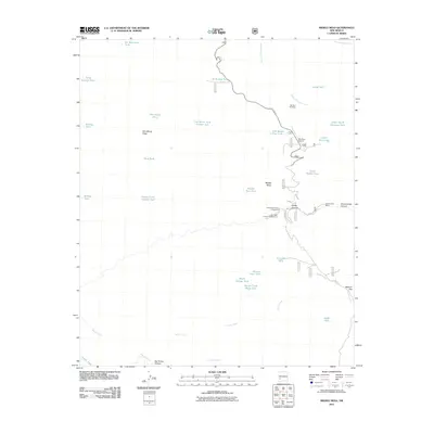
2011 Map of Middle Mesa
USGS Topo · Published 2011About this map
Middle Mesa and Tom Moore Mesa dominate this high-altitude landscape in Grant County, where the terrain is defined by a sophisticated network of water catchment systems and seasonal drainages. The map reveals a remote ranching and aviation footprint centered around Diamond Bar Ranch and the Me-Own Airport, alongside the Me Own Fire Base. These features, connected by State Rte 61 and N Star RD, highlight the area's dual role in private land use and public forest management. Water management is critical in this environment, evidenced by dozens of named tanks such as Tom Moore Tank Number Two and the Squaw Creek Ridge Tank. Recreation and conservation are also prominent, with the Upper Black Canyon Campground and Lower Black Canyon Campground situated near Hodge Canyon. The convergence of East Diamond Creek and South Diamond Creek in the north, alongside the winding course of Squaw Creek in the south, illustrates the complex hydrology of the Gila region.
Find a feature on this map
37 named features on this map. Tap any name to fly to it.
Don’t see what you’re looking for? This feature index may not catch every label — zoom into the map to look around manually.
Map Details
Editions of this 2011 Middle Mesa Map
This is the sole edition of this map. No revisions or reprints were ever made.
Other maps of this area

1911 · Alum Mountain
USGS Topo · 1:125,000

1913 · Alum Mountain
USGS Topo · 1:125,000

1949 · Lookout Mountain
USGS Topo · 1:62,500

1954 · Tularosa
USGS Topo · 1:250,000

1954 · Clifton
USGS Topo · 1:250,000

1957 · Clifton
USGS Topo · 1:250,000

1958 · Clifton
USGS Topo · 1:250,000

1958 · Tularosa
USGS Topo · 1:250,000

1962 · Clifton
USGS Topo · 1:250,000

1963 · Bonner Canyon
USGS Topo · 1:24,000