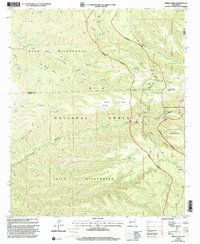
1999 Map of Middle Mesa
USGS Topo · Published 2002About this map
Gila National Forest encompasses this high-altitude landscape at the meeting point of Catron, Grant, and Sierra counties. The terrain is defined by massive plateaus like Middle Mesa and Tom Moore Mesa, which are separated by deep drainages such as Black Canyon and South Diamond Creek. The intersection of the Gila Wilderness and the Aldo Leopold Wilderness highlights the region's preservation, where the only human infrastructure consists of backcountry ranching and forest management sites. The Me-Own Administrative Site, accompanied by its own Landing Strip and Heliport, serves as a critical operational hub in this roadless environment. Numerous stock tanks, including Horse Pasture Tank and Tom Moore Tank, indicate the ongoing utility of these protected lands for grazing, while the Community Pasture Trail and Burnt Mountain Trail provide the primary means of navigation through the canyons.
Find a feature on this map
44 named features on this map. Tap any name to fly to it.
Don’t see what you’re looking for? This feature index may not catch every label — zoom into the map to look around manually.
Map Details
Editions of this 1999 Middle Mesa Map
This is the sole edition of this map. No revisions or reprints were ever made.
Other maps of this area

1911 · Alum Mountain
USGS Topo · 1:125,000

1913 · Alum Mountain
USGS Topo · 1:125,000

1949 · Lookout Mountain
USGS Topo · 1:62,500

1954 · Tularosa
USGS Topo · 1:250,000

1954 · Clifton
USGS Topo · 1:250,000

1957 · Clifton
USGS Topo · 1:250,000

1958 · Clifton
USGS Topo · 1:250,000

1958 · Tularosa
USGS Topo · 1:250,000

1962 · Clifton
USGS Topo · 1:250,000

1963 · Bonner Canyon
USGS Topo · 1:24,000