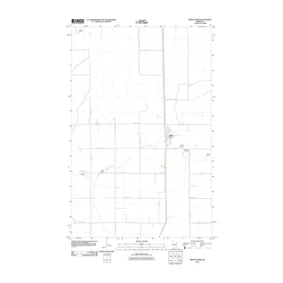
2010 Map of Middle River
USGS Topo · Published 2010About this map
Middle River serves as the focal point of this agricultural landscape in Marshall County, with the meandering waterway of the same name providing the primary drainage across the flat terrain. The settlement pattern is defined by a rigorous section-line grid of roads, including 130th Ave NE and 380th St NE, which connect the isolated homesteads and fields. The map is particularly notable for its density of burial sites, reflecting the diverse early community of this region. Family and denominational roots are evident at Finnish Lutheran Cemetery, Woodman Cemetery, and the Spruce Valley Cemetery. Further west, the Gaarde Cemetery and the northern Huntly Cemetery mark the enduring presence of long-established rural congregations and early settlers in this quiet corner of northern Minnesota.
Find a feature on this map
20 named features on this map. Tap any name to fly to it.
Don’t see what you’re looking for? This feature index may not catch every label — zoom into the map to look around manually.
Map Details
Editions of this 2010 Middle River Map
This is the sole edition of this map. No revisions or reprints were ever made.
Other maps of this area

1918 · Greenbush
USGS Topo · 1:62,500

1918 · Middle River
USGS Topo · 1:62,500

1919 · Pelan
USGS Topo · 1:62,500

1952 · Thief River Falls
USGS Topo · 1:250,000

1956 · Thief River Falls
USGS Topo · 1:250,000

1957 · Thief River Falls
USGS Topo · 1:250,000

1957 · Newfolden
USGS Topo · 1:62,500

1957 · Pelan
USGS Topo · 1:62,500
1961 · Middle River NE
USGS Topo · 1:24,000
1961 · Middle River SE
USGS Topo · 1:24,000