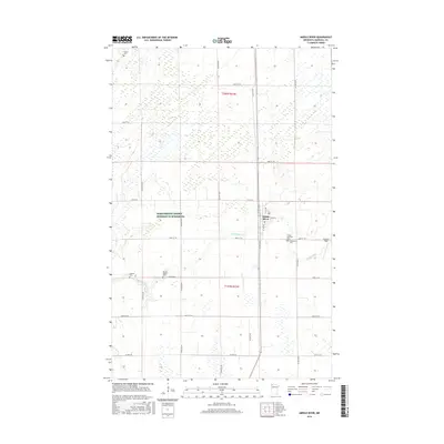
2016 Map of Middle River
USGS Topo · Published 2016About this map
Middle River serves as the central hub of this Marshall County landscape, where the namesake waterway winds through a grid of agricultural section lines and county roads. The settlement's layout is defined by the intersection of Co Hwy 6 and north-south routes, providing a glimpse into the organized land management of northern Minnesota. This survey is particularly valuable for genealogists, as it documents several distinct burial sites including the Finnish Lutheran Cem, Spruce Valley Cem, and Woodman Cem, reflecting the diverse cultural heritage and early pioneer communities of the region. To the east, Chanlin Field stands out as a named landmark near the river's path, while the northern reaches include the Huntly Cem and specialized tracts like the Farm Service Agency Interest of Minnesota, illustrating the continued importance of state-managed agricultural interests in the township.
Find a feature on this map
21 named features on this map. Tap any name to fly to it.
Don’t see what you’re looking for? This feature index may not catch every label — zoom into the map to look around manually.
Map Details
Editions of this 2016 Middle River Map
This is the sole edition of this map. No revisions or reprints were ever made.
Other maps of this area

1918 · Greenbush
USGS Topo · 1:62,500

1918 · Middle River
USGS Topo · 1:62,500

1919 · Pelan
USGS Topo · 1:62,500

1952 · Thief River Falls
USGS Topo · 1:250,000

1956 · Thief River Falls
USGS Topo · 1:250,000

1957 · Thief River Falls
USGS Topo · 1:250,000

1957 · Newfolden
USGS Topo · 1:62,500

1957 · Pelan
USGS Topo · 1:62,500
1961 · Middle River NE
USGS Topo · 1:24,000
1961 · Middle River SE
USGS Topo · 1:24,000