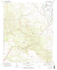
1969 Map of Middle Verde
USGS Topo · Published 1971About this map
The Verde River corridor dominates this 1969 survey, where the Camp Verde Military Reservation Boundary and the waters of the Eureka Ditch define the land use north of the Black Hills. The small settlement of Middle Verde sits near the river, while the former town of Aultman is noted only as a site, illustrating the shifting population centers of Yavapai County during the mid-20th century.
Find a feature on this map
42 named features on this map. Tap any name to fly to it.
Don’t see what you’re looking for? This feature index may not catch every label — zoom into the map to look around manually.
Map Details
Editions of this 1969 Middle Verde Map
2 editions found
Other maps of this area

1887 · Verde
USGS Topo · 1:250,000

1887 · Prescott
USGS Topo · 1:250,000

1892 · Verde
USGS Topo · 1:250,000

1892 · Prescott
USGS Topo · 1:250,000

1903 · Bradshaw Mountains
USGS Topo · 1:125,000

1905 · Jerome
USGS Topo · 1:125,000

1923 · Camp Verde
USGS Topo · 1:125,000

1929 · Turret Peak
USGS Topo · 1:125,000

1932 · Camp Verde
USGS Topo · 1:125,000

1933 · Turret Peak
USGS Topo · 1:125,000