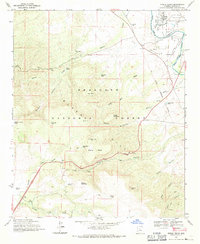
1969 Map of Middle Verde
USGS Topo · Published 1971About this map
Middle Verde and the nearby Aultman site represent the focal points of settlement along the eastern edge of the Prescott National Forest in the late 1960s. This survey illustrates an intricate irrigation network supporting local agriculture, featuring the Ok Ditch and Camp Ditch drawing from the Verde River. The landscape is dominated by significant relief, transitioning from the river basin up toward Grief Hill and the sprawling Pinto Mesa. Evidence of land use and history is etched into the terrain, from the Old Military Reservation Boundary to various stock tanks like Hull Hill Tank and Mistake Tank. Remote canyons such as Copper Canyon and Lucky Canyon cut through the high ground of Grassy Mountain, while several Prospects and a Mine suggest the area's mineral interests during this era.
Find a feature on this map
40 named features on this map. Tap any name to fly to it.
Don’t see what you’re looking for? This feature index may not catch every label — zoom into the map to look around manually.
Map Details
Editions of this 1969 Middle Verde Map
2 editions found
Other maps of this area

1887 · Verde
USGS Topo · 1:250,000

1887 · Prescott
USGS Topo · 1:250,000

1892 · Verde
USGS Topo · 1:250,000

1892 · Prescott
USGS Topo · 1:250,000

1903 · Bradshaw Mountains
USGS Topo · 1:125,000

1905 · Jerome
USGS Topo · 1:125,000

1923 · Camp Verde
USGS Topo · 1:125,000

1929 · Turret Peak
USGS Topo · 1:125,000

1932 · Camp Verde
USGS Topo · 1:125,000

1933 · Turret Peak
USGS Topo · 1:125,000