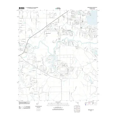
2012 Map of Middleburg
USGS Topo · Published 2012About this map
Middleburg Methodist Cem and the surrounding neighborhoods of Clay County reflect a landscape defined by the branching tributaries of the St. Johns River system. This era shows the residential expansion near Doctors Inlet and the planned communities surrounding Lake Asbury. The map illustrates the convergence of several waterways, including the S Fork Black Cr, N Fork Black Cr, and Black Cr, which historically facilitated transport and settlement in the region. Educational and municipal development is evident through the presence of the Saint Johns River Community College and the Clay County Ridaught Landing Wastewater Treatment Facility. Small local hubs like Peoria Point, Peoria Siding, and Rideout are interspersed with a dense network of residential streets, some bearing unique names like Rattlesnake Bend, showing the transition from rural riverside landings to suburban communities.
Find a feature on this map
201 named features on this map. Tap any name to fly to it.
Don’t see what you’re looking for? This feature index may not catch every label — zoom into the map to look around manually.
Map Details
Editions of this 2012 Middleburg Map
This is the sole edition of this map. No revisions or reprints were ever made.
Other maps of this area

1917 · Orange Park
USGS Topo · 1:62,500

1918 · Middleburg
USGS Topo · 1:62,500

1918 · Orange Park
USGS Topo · 1:62,500

1941 · Middleburg
USGS Topo · 1:62,500

1942 · Ates Creek
USGS Topo · 1:62,500

1947 · Bostwick
USGS Topo · 1:50,000

1948 · Jacksonville
USGS Topo · 1:250,000

1949 · Middleburg SW
USGS Topo · 1:24,000

1949 · Green Cove Springs
USGS Topo · 1:24,000

1949 · Fiftone
USGS Topo · 1:24,000