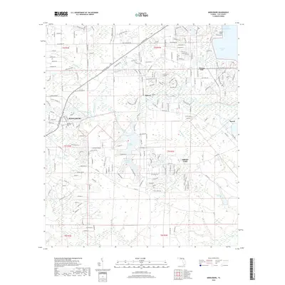
2018 Map of Middleburg
USGS Topo · Published 2018About this map
Middleburg sits at the strategic confluence of the North Fork Black Creek and South Fork Black Creek, a location defined by its extensive network of winding waterways and low-lying wetlands. The landscape transitions from the riverine environments of Black Creek to the suburban developments surrounding Lake Asbury and the community of Asbury Lake. Near the northeastern corner, the terrain meets the wider expanse of Doctors Lake at Peoria Point and Sugarhouse Cove, where the drainage of Little Black Creek and Mill Log Creek feeds into the larger basin.
Find a feature on this map
37 named features on this map. Tap any name to fly to it.
Don’t see what you’re looking for? This feature index may not catch every label — zoom into the map to look around manually.
Map Details
Editions of this 2018 Middleburg Map
This is the sole edition of this map. No revisions or reprints were ever made.
Other maps of this area

1917 · Orange Park
USGS Topo · 1:62,500

1918 · Middleburg
USGS Topo · 1:62,500

1918 · Orange Park
USGS Topo · 1:62,500

1941 · Middleburg
USGS Topo · 1:62,500

1942 · Ates Creek
USGS Topo · 1:62,500

1947 · Bostwick
USGS Topo · 1:50,000

1948 · Jacksonville
USGS Topo · 1:250,000

1949 · Middleburg SW
USGS Topo · 1:24,000

1949 · Green Cove Springs
USGS Topo · 1:24,000

1949 · Fiftone
USGS Topo · 1:24,000