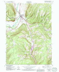
1944 Map of Middleburgh
USGS Topo · Published 1994About this map
Middleburgh serves as the central hub of this Schoharie Valley landscape, where the wide flats of Schoharie Creek meet the dramatic rise of Vromans Nose. The settlement pattern reflects a mid-20th-century rural economy, with small clusters like West Middleburgh and Huntersland connected by winding roads through The Gorge and various hollows. Educational and spiritual life is well-documented through landmarks such as Central Elem Sch, School No 5, and several historic congregations including the Reformed Ch and Valley Bible Ch.
Find a feature on this map
49 named features on this map. Tap any name to fly to it.
Don’t see what you’re looking for? This feature index may not catch every label — zoom into the map to look around manually.
Map Details
Editions of this 1944 Middleburgh Map
4 editions found
Other maps of this area

1893 · Durham
USGS Topo · 1:62,500

1894 · Durham
USGS Topo · 1:62,500

1898 · Schoharie
USGS Topo · 1:62,500

1900 · Schoharie
USGS Topo · 1:62,500

1900 · Schoharie
USGS Topo · 1:31,680

1900 · Berne
USGS Topo · 1:62,500

1901 · Gilboa
USGS Topo · 1:62,500

1903 · Gilboa
USGS Topo · 1:62,500

1903 · Berne
USGS Topo · 1:62,500

1943 · Cobleskill
USGS Topo · 1:24,000