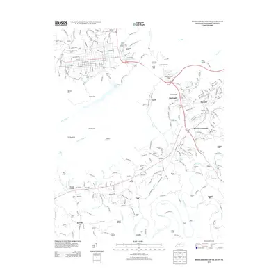
2013 Map of Middlesboro South
USGS Topo · Published 2013About this map
Cumberland Gap and the prominent Tri-State Peak anchor this transition between the Kentucky, Tennessee, and Virginia borders. The landscape is defined by the steep ridges of Powell Mountain, where deep cuts like Baptist Gap and Bennett Gap have guided travel for generations. Settlement patterns follow the valley floors, with community hubs such as Harrogate, Shawanee, and Arthur clustered near the foothills. Below these heights, the Powell River meanders through agricultural bottomlands, its course marked by historical sites like Minton Mill and Vancel Mill. The map reveals a high density of family-named landmarks and cemeteries, including the Cottrell Johnson Cem and Woodson Cem, which offer significant value for genealogical research. Large water features like Fern Lake and the Arthur Lake provide contrast to the narrow hollows such as Dead Horse Holw that score the mountainside.
Find a feature on this map
78 named features on this map. Tap any name to fly to it.
Don’t see what you’re looking for? This feature index may not catch every label — zoom into the map to look around manually.
Map Details
Editions of this 2013 Middlesboro South Map
This is the sole edition of this map. No revisions or reprints were ever made.
Other maps of this area

1886 · Cumberland Gap
USGS Topo · 1:125,000

1888 · Cumberland Gap
USGS Topo · 1:125,000

1891 · Cumberland Gap
USGS Topo · 1:125,000

1897 · Maynardville
USGS Topo · 1:125,000

1900 · Maynardville
USGS Topo · 1:125,000

1903 · Middlesboro
USGS Topo · 1:48,000

1927 · Middlesboro
USGS Topo · 1:62,500

1930 · Middlesboro
USGS Topo · 1:62,500

1935 · Varilla
USGS Topo · 1:24,000

1935 · Mingo Mountains
USGS Topo · 1:24,000