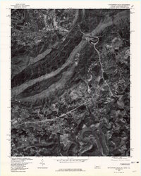
1976 Map of Middlesboro South
USGS Topo · Published 1981About this map
Cumberland Mountain forms the dramatic backbone of this mid-1970s orthophotographic study, bisecting the landscape where Kentucky, Tennessee, and Virginia converge. The urban grid of Middlesboro dominates the northwest corner, showing its development within the basin drained by Yellow Creek and the Yellow Creek Bypass. To the south, the terrain opens into the valley of the Powell River, where smaller rural settlements like Arthur and Shawanee are situated. This orthophoto provides a precise visual record of the land use in the bicentennial year, capturing the dense forest cover of the mountain ridges contrasted with the cleared agricultural parcels and residential expansion around Harrogate. The winding course of the Powell River is clearly visible as it meanders through the southern half of the quadrangle, serving as a primary landmark for researchers tracing family lands and early transportation routes through the Cumberland Gap region.
Find a feature on this map
14 named features on this map. Tap any name to fly to it.
Don’t see what you’re looking for? This feature index may not catch every label — zoom into the map to look around manually.
Map Details
Editions of this 1976 Middlesboro South Map
This is the sole edition of this map. No revisions or reprints were ever made.
Other maps of this area

1886 · Cumberland Gap
USGS Topo · 1:125,000

1888 · Cumberland Gap
USGS Topo · 1:125,000

1891 · Cumberland Gap
USGS Topo · 1:125,000

1897 · Maynardville
USGS Topo · 1:125,000

1900 · Maynardville
USGS Topo · 1:125,000

1903 · Middlesboro
USGS Topo · 1:48,000

1927 · Middlesboro
USGS Topo · 1:62,500

1930 · Middlesboro
USGS Topo · 1:62,500

1935 · Varilla
USGS Topo · 1:24,000

1935 · Mingo Mountains
USGS Topo · 1:24,000