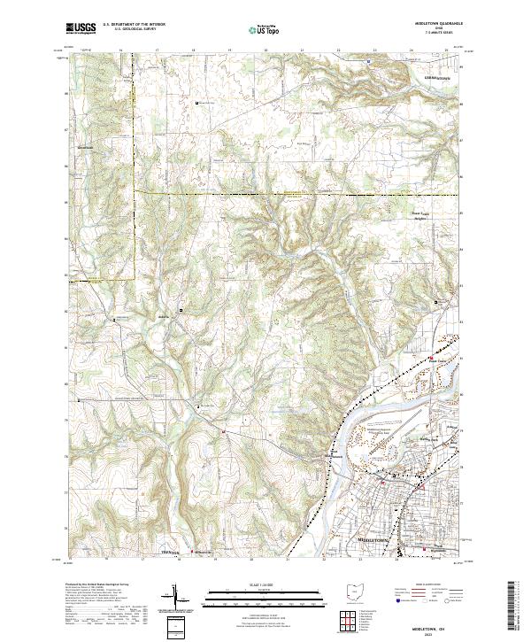
2023 Map of Middletown
USGS Topo · Published 2023About this map
The Great Miami River valley anchors this detailed look at southwestern Ohio, where the industrial and residential core of Middletown gives way to the agricultural uplands of Butler, Montgomery, and Preble counties. This modern survey illustrates the dense neighborhood structure of the city, highlighting districts like Harlan Park, Avalon, and South Highlands alongside vital infrastructure like Middletown Regional Airport/Hook Field. To the west and north, the landscape shifts toward a pattern of creek-fed valleys and smaller rural nodes.
Find a feature on this map
90 named features on this map. Tap any name to fly to it.
Don’t see what you’re looking for? This feature index may not catch every label — zoom into the map to look around manually.
Map Details
Editions of this 2023 Middletown Map
This is the sole edition of this map. No revisions or reprints were ever made.