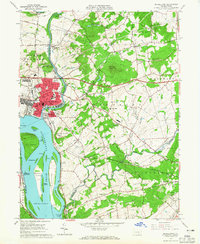
1963 Map of Middletown
USGS Topo · Published 1965About this map
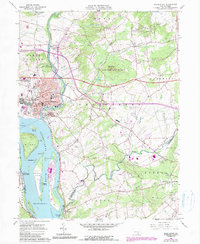
Susquehanna River islands and the industrial convergence at the mouth of Swatara Creek define this 1963 landscape. The town of Middletown is shown in detail, adjacent to the massive footprint of Olmsted AF Base, reflecting the area's mid-century military and logistical importance. The river is a complex archipelago of landforms, including Shelley Island, Hill Island, and Three Mile Island, several of which sit near the turbulent Conewago Falls at the southern bend.
Find a feature on this map
79 named features on this map. Tap any name to fly to it.
Don’t see what you’re looking for? This feature index may not catch every label — zoom into the map to look around manually.
Map Details
Editions of this 1963 Middletown Map
5 editions found
Other maps of this area

1892 · Hummelstown
USGS Topo · 1:62,500

1892 · Harrisburg
USGS Topo · 1:62,500

1899 · Harrisburg
USGS Topo · 1:62,500

1906 · New Cumberland
USGS Topo · 1:62,500

1908 · Middletown
USGS Topo · 1:62,500

1924 · Hummelstown
USGS Topo · 1:62,500

1924 · Harrisburg
USGS Topo · 1:62,500

1943 · New Cumberland
USGS Topo · 1:62,500

1943 · Middletown
USGS Topo · 1:62,500

1943 · Harrisburg
USGS Topo · 1:62,500