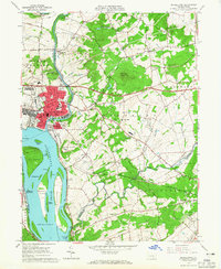
1963 Map of Middletown
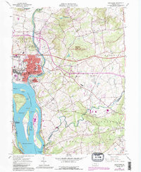
USGS Topo · Published 1990About this map
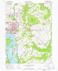
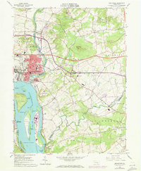
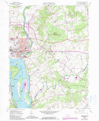
Three Mile Island dominates the bend of the Susquehanna River in this detailed look at the river corridor south of Harrisburg during the 1960s and through its 1990 updates. The industrial and residential center of Middletown and adjacent Royalton sit at the confluence of the river and Swatara Creek, showcasing a dense network of local schools including Roosevelt Oak Hill Sch, Fink Sch, and Feaser Sch. This area highlights the transition from traditional river-and-rail infrastructure, marked by the Reading Railroad, to the modern automotive era defined by the Pennsylvania Turnpike.
Find a feature on this map
75 named features on this map. Tap any name to fly to it.
Don’t see what you’re looking for? This feature index may not catch every label — zoom into the map to look around manually.
Map Details
Editions of this 1963 Middletown Map
5 editions found
Other maps of this area

1892 · Hummelstown
USGS Topo · 1:62,500

1892 · Harrisburg
USGS Topo · 1:62,500

1899 · Harrisburg
USGS Topo · 1:62,500

1906 · New Cumberland
USGS Topo · 1:62,500

1908 · Middletown
USGS Topo · 1:62,500

1924 · Hummelstown
USGS Topo · 1:62,500

1924 · Harrisburg
USGS Topo · 1:62,500

1943 · New Cumberland
USGS Topo · 1:62,500

1943 · Middletown
USGS Topo · 1:62,500

1943 · Harrisburg
USGS Topo · 1:62,500