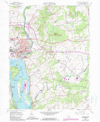
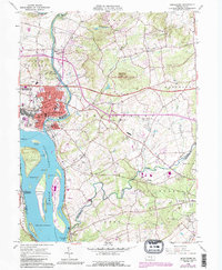
1963 Map of Middletown
USGS Topo · Published 1990About this map
Middletown and Royalton occupy the strategic high ground where Swatara Creek meets the wide expanse of the Susquehanna River in this 1960s survey. The landscape is defined by the complex river geography, featuring a series of large islands including Hill Island, Shelley Island, and Beech Island above the Conewago Falls. The town center shows dense development with institutions like St Marys Sch and St Peters Ch nestled among established residential blocks. Outlying areas reveal a mix of early suburban growth and industrial infrastructure, from the Masonic Homes in the south to the Quarry sites near Waltonville. Cultural landmarks of the mid-century era are visible, including a Drive-In Theater and the Pennsylvania Toll Road Turnpike, illustrating the region's role as a major transportation corridor between the river and the inland counties.
Find a feature on this map
66 named features on this map. Tap any name to fly to it.
Don’t see what you’re looking for? This feature index may not catch every label — zoom into the map to look around manually.
Map Details
Editions of this 1963 Middletown Map
5 editions found
Other maps of this area

1892 · Hummelstown
USGS Topo · 1:62,500

1892 · Harrisburg
USGS Topo · 1:62,500

1899 · Harrisburg
USGS Topo · 1:62,500

1906 · New Cumberland
USGS Topo · 1:62,500

1908 · Middletown
USGS Topo · 1:62,500

1924 · Hummelstown
USGS Topo · 1:62,500

1924 · Harrisburg
USGS Topo · 1:62,500

1943 · New Cumberland
USGS Topo · 1:62,500

1943 · Middletown
USGS Topo · 1:62,500

1943 · Harrisburg
USGS Topo · 1:62,500