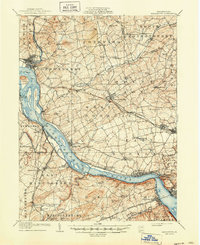
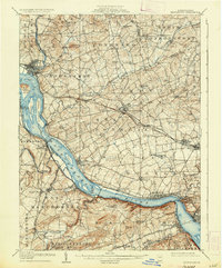
1908 Map of Middletown
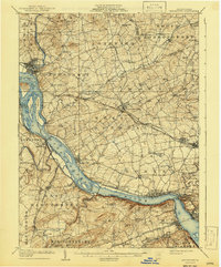
USGS Topo · Published 1950About this map
The Susquehanna River dominates this early twentieth-century landscape, serving as the industrial and logistical spine for southeastern Pennsylvania. Along its banks, the Pennsylvania Canal (Abandoned) runs parallel to a network of active railroads, including the Philadelphia Division and the Northern Central RR. Significant river features like Threemile Island and Haldeman Riffles are documented before modern development altered the waterway's character.
Find a feature on this map
116 named features on this map. Tap any name to fly to it.
Don’t see what you’re looking for? This feature index may not catch every label — zoom into the map to look around manually.
Map Details
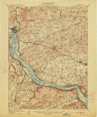
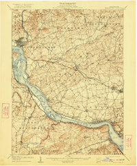
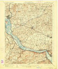
Editions of this 1908 Middletown Map
7 editions found
Other maps of this area

1891 · Lebanon
USGS Topo · 1:62,500

1892 · Hummelstown
USGS Topo · 1:62,500

1892 · Harrisburg
USGS Topo · 1:62,500

1893 · Lebanon
USGS Topo · 1:62,500

1899 · Lebanon
USGS Topo · 1:62,500

1899 · Harrisburg
USGS Topo · 1:62,500

1902 · Lancaster
USGS Topo · 1:62,500

1904 · Lancaster
USGS Topo · 1:62,500

1906 · New Cumberland
USGS Topo · 1:62,500

1908 · Middletown
USGS Topo · 1:62,500