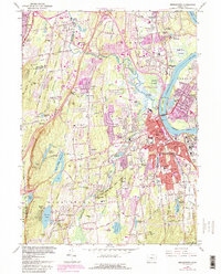
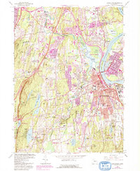
1965 Map of Middletown
USGS Topo · Published 1992About this map
The Connecticut River flows past the concentrated development of Middletown and Cromwell in this late-twentieth-century revision. The urban core is anchored by the sprawling campus of Wesleyan University and significant institutional landmarks like Indian Hill Cemetery. This edition, featuring 1991 aerial photograph updates shown in purple, highlights the expansion of residential neighborhoods like Bretton Heights and Lakeridge Heights against the older industrial and educational foundations of the region.
Find a feature on this map
98 named features on this map. Tap any name to fly to it.
Don’t see what you’re looking for? This feature index may not catch every label — zoom into the map to look around manually.
Map Details
Editions of this 1965 Middletown Map
5 editions found
Other maps of this area

1892 · New Haven
USGS Topo · 1:62,500

1892 · Meriden
USGS Topo · 1:62,500

1893 · Guilford
USGS Topo · 1:62,500

1893 · Middletown
USGS Topo · 1:62,500

1893 · Meriden
USGS Topo · 1:62,500

1906 · Farmington
USGS Topo · 1:125,000

1921 · New Haven
USGS Topo · 1:62,500

1928 · Cromwell
USGS Topo · 1:24,000

1928 · Glastonbury
USGS Topo · 1:24,000

1943 · Durham
USGS Topo · 1:25,000