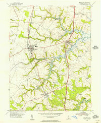
1953 Map of Middletown
USGS Topo · Published 1956About this map
Pennsylvania railroad tracks bisect the New Castle County landscape, connecting the agricultural hubs of Middletown and Townsend during the early 1950s. This survey reveals a transition from traditional rural patterns to modern corridors, as the Dupont Parkway cuts through older settlements like McDonough and Fieldsboro. The geography is defined by a series of creeks flowing east toward the Delaware River, including the Appoquinimink River and Blackbird Creek, which provided historical access points such as Blackbird Landing.
Find a feature on this map
44 named features on this map. Tap any name to fly to it.
Don’t see what you’re looking for? This feature index may not catch every label — zoom into the map to look around manually.
Map Details
Editions of this 1953 Middletown Map
2 editions found
Other maps of this area

1898 · Elkton
USGS Topo · 1:62,500

1899 · Dover
USGS Topo · 1:125,000

1900 · Elkton
USGS Topo · 1:62,500

1900 · Cecilton
USGS Topo · 1:62,500

1904 · Wilmington
USGS Topo · 1:62,500

1906 · Dover
USGS Topo · 1:125,000

1906 · Wilmington
USGS Topo · 1:62,500

1917 · Elkton
USGS Topo · 1:62,500

1919 · Wilmington
USGS Topo · 1:62,500

1920 · Dover
USGS Topo · 1:125,000