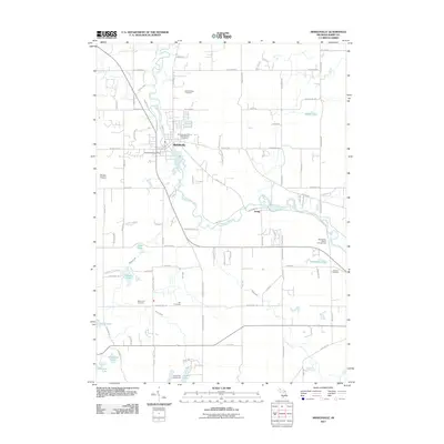
2011 Map of Middleville
USGS Topo · Published 2011About this map
The Thornapple River carves a winding path through this portion of Barry County, anchoring the settlements of Middleville and Irving. In the northern half of the sheet, the village of Middleville serves as a central hub, evidenced by the Middleville Post Office and its residential grid extending toward Duncan Creek. This 2011 survey reveals a landscape deeply connected to its local heritage, preserving several family and fraternal burial grounds such as the International Order of Odd Fellows Cemetery and Bowerman Cemetery. To the west, the distinct terrain of Scales Prairie offers a contrast to the water-rich geography of the south, where Bassett Lake, Hathaway Lake, and Shaw Lake provide a mosaic of glacial hydrology. These features, along with recreation spots like Sharp Park Campground, illustrate the area's balance between small-town infrastructure and the natural riparian corridor.
Find a feature on this map
100 named features on this map. Tap any name to fly to it.
Don’t see what you’re looking for? This feature index may not catch every label — zoom into the map to look around manually.
Map Details
Editions of this 2011 Middleville Map
This is the sole edition of this map. No revisions or reprints were ever made.
Other maps of this area

1914 · Grand Rapids
USGS Topo · 1:62,500

1918 · Lowell
USGS Topo · 1:62,500

1943 · Grand Rapids
USGS Topo · 1:62,500

1943 · Lowell
USGS Topo · 1:62,500

1951 · Hastings
USGS Topo · 1:62,500

1958 · Grand Rapids
USGS Topo · 1:250,000

1959 · Wayland
USGS Topo · 1:62,500

1961 · Grand Rapids
USGS Topo · 1:250,000

1962 · Grand Rapids
USGS Topo · 1:250,000
1967 · Caledonia
USGS Topo · 1:24,000