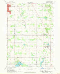
1967 Map of Caledonia
USGS Topo · Published 1969About this map
The village of Caledonia and the surrounding township lands of Gaines and Cascade are captured here in the late 1960s, a period defined by the transition from rural agricultural plots to suburban expansion. The Penn Central rail line cuts diagonally across the landscape, serving the small community of Dutton and providing a vital transit link toward Grand Rapids. This era shows the early footprint of the Kent County Airport at the northern edge, signaling the region's increasing connectivity and growth beyond its traditional farming roots.
Find a feature on this map
64 named features on this map. Tap any name to fly to it.
Don’t see what you’re looking for? This feature index may not catch every label — zoom into the map to look around manually.
Map Details
Editions of this 1967 Caledonia Map
3 editions found
Other maps of this area

1914 · Grand Rapids
USGS Topo · 1:62,500

1918 · Lowell
USGS Topo · 1:62,500

1943 · Grand Rapids
USGS Topo · 1:62,500

1943 · Lowell
USGS Topo · 1:62,500

1951 · Hastings
USGS Topo · 1:62,500

1958 · Grand Rapids
USGS Topo · 1:250,000

1959 · Wayland
USGS Topo · 1:62,500

1961 · Grand Rapids
USGS Topo · 1:250,000

1962 · Grand Rapids
USGS Topo · 1:250,000
1967 · Grand Rapids West
USGS Topo · 1:24,000
Featured Places
- Kentwood, MI
- Gaines Charter Township, MI
- Cascade Charter Township, MI
- Caledonia, MI
- Dutton, Gaines Charter Township