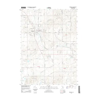
2014 Map of Middleville
USGS Topo · Published 2014About this map
Middleville sits along the winding path of the Thornapple River, serving as a central hub for this portion of Barry County. The settlement pattern reveals a mix of established village blocks and expanding residential reaches, notably toward Irving to the southeast. For genealogists, the map is particularly detailed regarding local burials, documenting the International Order of Odd Fellows Cem and Mt Hope Cem near the town center, as well as several rural sites including Hill Cem, Bowerman Cem, and Rutland Cem. The surrounding landscape is defined by a dense network of glacial water bodies, from the larger Bassett Lake and Shaw Lake to smaller basins like Black Lake and Hathaway Lake. These lakes are connected by a web of small streams including Turner Cr and Glass Cr, which drain the undulating terrain typical of the Michigan interior.
Find a feature on this map
122 named features on this map. Tap any name to fly to it.
Don’t see what you’re looking for? This feature index may not catch every label — zoom into the map to look around manually.
Map Details
Editions of this 2014 Middleville Map
This is the sole edition of this map. No revisions or reprints were ever made.
Other maps of this area

1914 · Grand Rapids
USGS Topo · 1:62,500

1918 · Lowell
USGS Topo · 1:62,500

1943 · Grand Rapids
USGS Topo · 1:62,500

1943 · Lowell
USGS Topo · 1:62,500

1951 · Hastings
USGS Topo · 1:62,500

1958 · Grand Rapids
USGS Topo · 1:250,000

1959 · Wayland
USGS Topo · 1:62,500

1961 · Grand Rapids
USGS Topo · 1:250,000

1962 · Grand Rapids
USGS Topo · 1:250,000
1967 · Caledonia
USGS Topo · 1:24,000