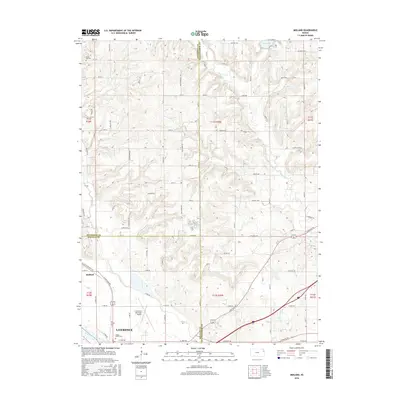
2016 Map of Midland
USGS Topo · Published 2016About this map
Lawrence and the surrounding river bottomlands are the focal point of this 2016 survey, which highlights the area's complex boundary lines and agricultural layout. The northern edge of the city sits just south of the Kansas River, where the Lawrence Municipal Airport occupies a large flat stretch of land protected by a network of levees. To the northwest, the small settlement of Midland is situated at a junction of regional roads, marking a transition from the urban periphery into the rolling hills of Douglas and Jefferson Counties.
Find a feature on this map
88 named features on this map. Tap any name to fly to it.
Don’t see what you’re looking for? This feature index may not catch every label — zoom into the map to look around manually.
Map Details
Editions of this 2016 Midland Map
This is the sole edition of this map. No revisions or reprints were ever made.
Other maps of this area

1885 · Lawrence
USGS Topo · 1:125,000

1886 · Oskaloosa
USGS Topo · 1:125,000

1888 · Oskaloosa
USGS Topo · 1:125,000

1889 · Lawrence
USGS Topo · 1:125,000

1894 · Oskaloosa
USGS Topo · 1:125,000

1947 · Lawrence
USGS Topo · 1:250,000

1948 · Jarbalo
USGS Topo · 1:24,000

1949 · Williamstown
USGS Topo · 1:24,000

1950 · Kansas City
USGS Topo · 1:250,000

1950 · Williamstown
USGS Topo · 1:24,000