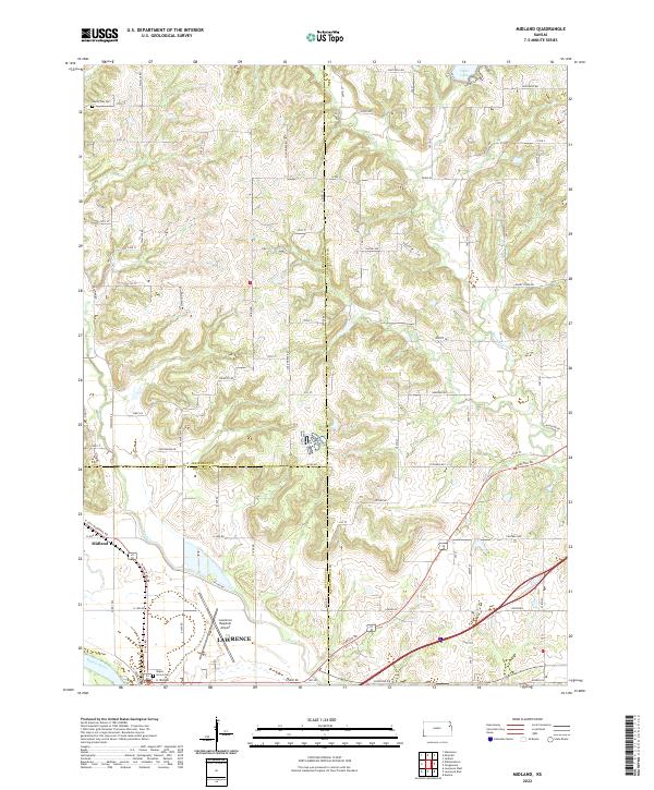
2022 Map of Midland
USGS Topo · Published 2022About this map
The Kansas River corridor north of Lawrence forms the backbone of this landscape, where the confluence of regional travel and river geography defines the area. The small settlement of Midland sits at a critical junction of road and rail near the Douglas and Jefferson County line, serving as a gateway to the more developed industrial and transportation hubs to the south. The Lawrence Regional Airport occupies a prominent position on the flatlands north of the river, while the surrounding terrain is dissected by Ninemile Cr and Mud Cr.
Find a feature on this map
56 named features on this map. Tap any name to fly to it.
Don’t see what you’re looking for? This feature index may not catch every label — zoom into the map to look around manually.
Map Details
Editions of this 2022 Midland Map
This is the sole edition of this map. No revisions or reprints were ever made.
Other maps of this area

1885 · Lawrence
USGS Topo · 1:125,000

1886 · Oskaloosa
USGS Topo · 1:125,000

1888 · Oskaloosa
USGS Topo · 1:125,000

1889 · Lawrence
USGS Topo · 1:125,000

1894 · Oskaloosa
USGS Topo · 1:125,000

1947 · Lawrence
USGS Topo · 1:250,000

1948 · Jarbalo
USGS Topo · 1:24,000

1949 · Williamstown
USGS Topo · 1:24,000

1950 · Kansas City
USGS Topo · 1:250,000

1950 · Williamstown
USGS Topo · 1:24,000