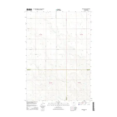
2015 Map of Midland NE
USGS Topo · Published 2015About this map
Big Prairie Dog Cr and Little Prairie Dog Cr carve a complex network of drainage across this section of the Great Plains, where the borders of Stanley, Haakon, and Jones counties converge. This 2015 survey reveals a landscape defined by expansive section lines and a sparse network of rural roads that adapt to the meandering creek beds. While the terrain is dominated by open rangeland, local travel is facilitated by corridors such as S Brown Church Rd, Bad River Rd, and Morgan Rd. The map provides a clear look at the intersection of Stanley Co Jones Co and Haakon Co Jones Co, illustrating how these administrative boundaries were established relative to the natural topography of the South Dakota interior during the early 21st century.
Find a feature on this map
21 named features on this map. Tap any name to fly to it.
Don’t see what you’re looking for? This feature index may not catch every label — zoom into the map to look around manually.
Map Details
Editions of this 2015 Midland NE Map
This is the sole edition of this map. No revisions or reprints were ever made.
Other maps of this area

1951 · Capa
USGS Topo · 1:24,000

1951 · Capa NW
USGS Topo · 1:24,000

1954 · Midland
USGS Topo · 1:24,000

1954 · Midland SE
USGS Topo · 1:24,000

1954 · Pierre
USGS Topo · 1:250,000

1958 · Pierre
USGS Topo · 1:250,000

1982 · Hayes South
USGS Topo · 1:24,000

1982 · Hohrman Ranch
USGS Topo · 1:24,000
1982 · Midland NE
USGS Topo · 1:24,000

1982 · Midland NW
USGS Topo · 1:24,000