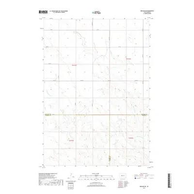
2017 Map of Midland NE
USGS Topo · Published 2017About this map
Big Prairie Dog Cr and Little Prairie Dog Cr carve their way through the expansive range country at the convergence of three South Dakota counties. This remote interior landscape is defined by the tri-point where the Stanley-Jones and Haakon-Jones county lines meet. The survey reveals a sparse but persistent grid of section roads, including S Brown Rd and several numbered thoroughfares like 218th St and 259th Ave, which provide the only access across the high plains. The drainage patterns of the creeks illustrate the erosion-carved topography of the region, where seasonal water flow has shaped the land long before the modern township and range lines were established.
Find a feature on this map
20 named features on this map. Tap any name to fly to it.
Don’t see what you’re looking for? This feature index may not catch every label — zoom into the map to look around manually.
Map Details
Editions of this 2017 Midland NE Map
This is the sole edition of this map. No revisions or reprints were ever made.
Other maps of this area

1951 · Capa
USGS Topo · 1:24,000

1951 · Capa NW
USGS Topo · 1:24,000

1954 · Midland
USGS Topo · 1:24,000

1954 · Midland SE
USGS Topo · 1:24,000

1954 · Pierre
USGS Topo · 1:250,000

1958 · Pierre
USGS Topo · 1:250,000

1982 · Hayes South
USGS Topo · 1:24,000

1982 · Hohrman Ranch
USGS Topo · 1:24,000
1982 · Midland NE
USGS Topo · 1:24,000

1982 · Midland NW
USGS Topo · 1:24,000