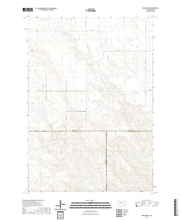
2021 Map of Midland NE
USGS Topo · Published 2021About this map
Big Prairie Dog Cr and Little Prairie Dog Cr define the drainage patterns of this central South Dakota landscape, where the prairie is carved by seasonal watercourses. This area represents a tri-county junction where Stanley, Haakon, and Jones counties meet along a surveyed boundary line. The terrain is structured by a regular grid of section lines and local roads like 218th St and 252nd Ave, reflecting the enduring Public Land Survey System. Modern infrastructure is represented by the Bad River Rd in the northeast, which provides access through this sparsely populated ranching country. The map illustrates a classic Great Plains layout where vast open spaces are organized by precise geographic coordinates and the winding paths of intermittent creeks.
Find a feature on this map
20 named features on this map. Tap any name to fly to it.
Don’t see what you’re looking for? This feature index may not catch every label — zoom into the map to look around manually.
Map Details
Editions of this 2021 Midland NE Map
This is the sole edition of this map. No revisions or reprints were ever made.
Other maps of this area

1951 · Capa
USGS Topo · 1:24,000

1951 · Capa NW
USGS Topo · 1:24,000

1954 · Midland
USGS Topo · 1:24,000

1954 · Midland SE
USGS Topo · 1:24,000

1954 · Pierre
USGS Topo · 1:250,000

1958 · Pierre
USGS Topo · 1:250,000

1982 · Hayes South
USGS Topo · 1:24,000

1982 · Hohrman Ranch
USGS Topo · 1:24,000
1982 · Midland NE
USGS Topo · 1:24,000

1982 · Midland NW
USGS Topo · 1:24,000