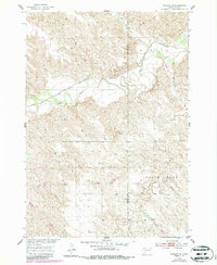
1954 Map of Midland SE
USGS Topo · Published 1987About this map
Chicago and North Western tracks trace the path of the Bad River as it cuts through the West River landscape of Haakon and Jones counties. This 1954 field-checked survey reveals the rural character of the area, punctuated by the small settlement of Madsen and several natural landmarks like Lone Tree Creek and Ash Draw. The presence of Gravel Pits along the railway line reflects the local infrastructure needs during the mid-20th century development of the Missouri River Basin.
Find a feature on this map
11 named features on this map. Tap any name to fly to it.
Don’t see what you’re looking for? This feature index may not catch every label — zoom into the map to look around manually.
Map Details
Editions of this 1954 Midland SE Map
2 editions found
Other maps of this area

1951 · Capa
USGS Topo · 1:24,000

1951 · Capa NW
USGS Topo · 1:24,000

1954 · Midland
USGS Topo · 1:24,000

1954 · Midland SE
USGS Topo · 1:24,000

1954 · Pierre
USGS Topo · 1:250,000

1955 · Martin
USGS Topo · 1:250,000

1958 · Pierre
USGS Topo · 1:250,000

1958 · Martin
USGS Topo · 1:250,000

1972 · Okaton
USGS Topo · 1:24,000

1972 · Stamford NW
USGS Topo · 1:24,000