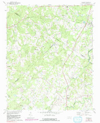
1971 Map of Midland
USGS Topo · Published 1992About this map
Norfolk Southern tracks traverse the northern landscape, anchoring the community of Midland and the nearby Mill Grove Ch Cem. This region, where Cabarrus, Mecklenburg, and Union Counties converge, is defined by a dense network of rural landmarks and small settlements including Allen, Brief, and Fairview. The drainage pattern is complex, with Muddy Creek and Clear Creek feeding toward the Rocky River in the east.
Find a feature on this map
37 named features on this map. Tap any name to fly to it.
Don’t see what you’re looking for? This feature index may not catch every label — zoom into the map to look around manually.
Map Details
Editions of this 1971 Midland Map
3 editions found
Other maps of this area

1941 · Charlotte
USGS Topo · 1:125,000

1942 · Charlotte
USGS Topo · 1:125,000

1949 · Harrisburg
USGS Topo · 1:24,000

1949 · Wilgrove
USGS Topo · 1:24,000

1949 · Midland
USGS Topo · 1:24,000

1949 · Concord SE
USGS Topo · 1:24,000

1953 · Charlotte
USGS Topo · 1:250,000

1954 · Charlotte
USGS Topo · 1:250,000

1957 · Mount Pleasant
USGS Topo · 1:62,500

1960 · Charlotte
USGS Topo · 1:250,000