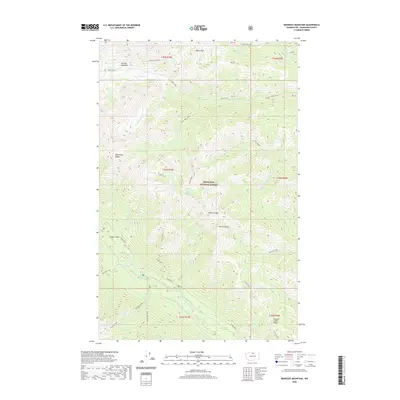
2020 Map of Midnight Mountain
USGS Topo · Published 2020About this map
Okanogan National Forest covers this high-elevation landscape in the North Cascades, where glacial carved valleys and steep ridgelines define the watershed. The Twisp River flows through the southern portion of the quadrangle, joined by tributaries like Reynolds Cr and Williams Cr. In the northern reaches, Gardner Meadows sits near the headwaters of Wolf Cr, providing a rare pocket of level terrain amidst the sharp peaks of Abernathy Ridge and Milton Mtn.
Find a feature on this map
37 named features on this map. Tap any name to fly to it.
Don’t see what you’re looking for? This feature index may not catch every label — zoom into the map to look around manually.
Map Details
Editions of this 2020 Midnight Mountain Map
This is the sole edition of this map. No revisions or reprints were ever made.
Other maps of this area

1899 · Methow
USGS Topo · 1:125,000

1901 · Methow
USGS Topo · 1:125,000

1902 · Stehekin
USGS Topo · 1:125,000

1904 · Stehekin
USGS Topo · 1:125,000

1920 · Slate Pass
USGS Topo · 1:125,000

1955 · Concrete
USGS Topo · 1:250,000

1958 · Concrete
USGS Topo · 1:250,000

1962 · Concrete
USGS Topo · 1:250,000

1962 · Mazama
USGS Topo · 1:62,500

1963 · Silver Star Mtn.
USGS Topo · 1:24,000