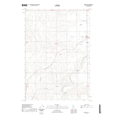
2020 Map of Midvale Hill
USGS Topo · Published 2020About this map
Midvale and the surrounding high country of Washington County are defined by the winding course of the Weiser River and the tributary canyons that feed it. The landscape transition from the agricultural flats of Shoe Peg Valley to the prominent rise of Midvale Hill illustrates the geography of this rural corridor. Transportation and recreation follow the water, with the Weiser River National Recreation Trail tracing the river's path past the small community of Diamond. This 2020 survey also captures modern aviation infrastructure at the Lee Williams Memorial Airport and the complex network of drainage creeks like Thousand Springs Cr and Sheep Cr that carve through the local topography. Further south, the settlement of Barton sits near the intersection of the river valley and Thousand Springs Valley Rd, showing the enduring reliance on these natural travel corridors.
Find a feature on this map
34 named features on this map. Tap any name to fly to it.
Don’t see what you’re looking for? This feature index may not catch every label — zoom into the map to look around manually.
Map Details
Editions of this 2020 Midvale Hill Map
This is the sole edition of this map. No revisions or reprints were ever made.
Other maps of this area

1897 · Weiser
USGS Topo · 1:125,000

1953 · Mann Creek
USGS Topo · 1:62,500

1955 · Baker
USGS Topo · 1:250,000

1957 · Cambridge
USGS Topo · 1:62,500

1957 · Crane Creek Reservoir
USGS Topo · 1:62,500

1957 · Sturgill Peak
USGS Topo · 1:62,500

1959 · Baker
USGS Topo · 1:250,000
1974 · Mann Creek SW
USGS Topo · 1:24,000

1980 · McCall
USGS Topo · 1:100,000

1980 · Weiser
USGS Topo · 1:100,000