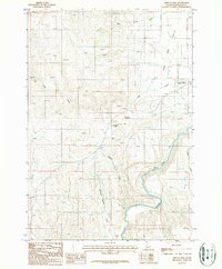
1987 Map of Midvale Hill
USGS Topo · Published 1987About this map
Weiser River drainage patterns and the transport corridor of the Union Pacific railroad define this portion of Washington County in the late 1980s. The landscape is characterized by the broad Shoe Peg Valley to the north and the prominent elevation of Midvale Hill central to the quadrangle. Local infrastructure is concentrated along the river valley, where the Lee Williams Memorial Airport and Roadside Park are situated near the highway route.
Find a feature on this map
16 named features on this map. Tap any name to fly to it.
Don’t see what you’re looking for? This feature index may not catch every label — zoom into the map to look around manually.
Map Details
Editions of this 1987 Midvale Hill Map
This is the sole edition of this map. No revisions or reprints were ever made.
Other maps of this area

1897 · Weiser
USGS Topo · 1:125,000

1953 · Mann Creek
USGS Topo · 1:62,500

1955 · Baker
USGS Topo · 1:250,000

1957 · Cambridge
USGS Topo · 1:62,500

1957 · Crane Creek Reservoir
USGS Topo · 1:62,500

1957 · Sturgill Peak
USGS Topo · 1:62,500

1959 · Baker
USGS Topo · 1:250,000
1974 · Mann Creek SW
USGS Topo · 1:24,000

1980 · McCall
USGS Topo · 1:100,000

1980 · Weiser
USGS Topo · 1:100,000