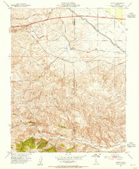
1953 Map of Midway
USGS Topo · Published 1955About this map
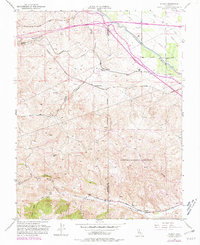
Altamont Pass serves as the central focal point for this early 1950s survey, marking a critical corridor for transportation and water infrastructure at the border of Alameda and San Joaquin counties. The landscape is dominated by the parallel tracks of the Western Pacific and Southern Pacific railroads, which share the low ground near Midway. A newly constructed Delta-Mendota Canal cuts across the northeastern terrain, illustrating the era's significant investment in California's water delivery systems. To the south, the deep drainage of Corral Hollow reveals a different layer of history, where the former industrial outposts of Tesla (Site), Carnegie (Site), and a Pottery (Site) are documented as archaeological footprints. This transition from active mining and manufacturing sites to a region primarily supporting transit and ranching through Mountain House and Midway Siding captures a moment of significant economic shift in the East Bay hinterlands.
Find a feature on this map
30 named features on this map. Tap any name to fly to it.
Don’t see what you’re looking for? This feature index may not catch every label — zoom into the map to look around manually.
Map Details
Editions of this 1953 Midway Map
6 editions found
Other maps of this area

1907 · Tesla
USGS Topo · 1:62,500

1911 · Byron Hot Springs
USGS Topo · 1:31,680

1914 · Bethany
USGS Topo · 1:31,680

1914 · Union Island
USGS Topo · 1:31,680

1916 · Byron Hot Springs
USGS Topo · 1:31,680

1916 · Byron
USGS Topo · 1:62,500

1916 · Tracy
USGS Topo · 1:31,680

1916 · Midway
USGS Topo · 1:31,680

1922 · Carbona
USGS Topo · 1:62,500

1940 · Byron
USGS Topo · 1:62,500