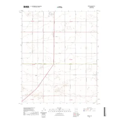
2023 Map of Midway
USGS Topo · Published 2023About this map
The settlement of Cameo anchors the southern portion of this high plains landscape, situated along a network of section-line roads and rural corridors. This contemporary survey reveals a transition between organized agricultural townships and the northern expansion of industrial or residential developments near Community Homesites. The infrastructure of the region is defined by the strict cardinal grid of the Public Land Survey System, with the boundary between Curry Co and Roosevelt Co bisecting the terrain. Local transit is facilitated by numerous numbered and lettered county routes, alongside specialized corridors like Swift Plant Rd and Graham Ln, reflecting the modern logistical and agricultural needs of the eastern New Mexico panhandle. Significant local thoroughfares such as S Prince St and S Fork Dr provide connectivity to larger regional hubs beyond the immediate map area.
Find a feature on this map
44 named features on this map. Tap any name to fly to it.
Don’t see what you’re looking for? This feature index may not catch every label — zoom into the map to look around manually.
Map Details
Editions of this 2023 Midway Map
This is the sole edition of this map. No revisions or reprints were ever made.
Other maps of this area

1954 · Clovis
USGS Topo · 1:250,000

1957 · Portair
USGS Topo · 1:62,500

1957 · Clovis
USGS Topo · 1:62,500

1957 · Arch
USGS Topo · 1:62,500

1957 · Portales
USGS Topo · 1:62,500

1958 · Clovis
USGS Topo · 1:250,000

1985 · Portair
USGS Topo · 1:24,000

1985 · Midway
USGS Topo · 1:24,000

1985 · Pleasure Lake
USGS Topo · 1:24,000
1985 · Farwell
USGS Topo · 1:24,000