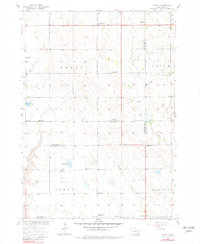
1957 Map of Midway
USGS Topo · Published 1981About this map
Agricultural life in the late 1950s is defined by a dense network of country schoolhouses and parish churches across the plains of southeastern South Dakota. The township of Molan and parts of Salem, Jamesville, and Mayfield show a landscape meticulously partitioned by section lines, where community life centered on landmarks like Independence Sch, Salem Ch, and Morningstar Sch. Small bodies of water such as Ulmer Lake and Guthmiller Lake provide natural breaks in the grid, while Clay Creek and Mud Creek meander toward the southern border near the settlement of Midway. The presence of numerous family-named institutions, including Schaeffer Sch and Ulmer Cem, offers a detailed look at the rural social geography before the widespread consolidation of small school districts and congregations.
Find a feature on this map
32 named features on this map. Tap any name to fly to it.
Don’t see what you’re looking for? This feature index may not catch every label — zoom into the map to look around manually.
Map Details
Editions of this 1957 Midway Map
2 editions found
Other maps of this area

1898 · Olivet
USGS Topo · 1:125,000

1898 · Parker
USGS Topo · 1:125,000

1955 · Sioux Falls
USGS Topo · 1:250,000

1957 · Mayfield
USGS Topo · 1:24,000

1957 · Midway
USGS Topo · 1:24,000

1957 · Menno
USGS Topo · 1:24,000

1957 · Wolf Creek
USGS Topo · 1:24,000

1957 · Jamesville
USGS Topo · 1:24,000

1958 · Sioux Falls
USGS Topo · 1:250,000

1970 · Turkey Ridge
USGS Topo · 1:24,000