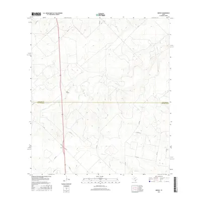
2016 Map of Midway
USGS Topo · Published 2016About this map
Midway sits at the intersection of rural South Texas transit routes, marking a quiet point in the landscape where FM 624 and FM 624 E converge. This 2016 survey illustrates the ranch-land character of the border between Live Oak and Jim Wells counties, defined by a network of seasonal drainages and local county roads. The terrain is shaped by the intermittent flows of Lagarto Cr and Longoria Cr, which meander through the scrubland towards the southeast. A notable geographic feature, Dix Hollow, provides local relief in an otherwise subtly rolling plain. The distribution of named trails, such as Yucca Trl and Wild Horse Trl, alongside numerous county roads like Co RD 308 and Co RD 228, reveals a landscape organized around large-scale agricultural and ranching parcels common to this region of the state.
Find a feature on this map
24 named features on this map. Tap any name to fly to it.
Don’t see what you’re looking for? This feature index may not catch every label — zoom into the map to look around manually.
Map Details
Editions of this 2016 Midway Map
This is the sole edition of this map. No revisions or reprints were ever made.
Other maps of this area

1920 · Mikeska
USGS Topo · 1:125,000

1920 · San Diego
USGS Topo · 1:62,500

1925 · Mathis No. 2
USGS Topo · 1:48,000

1925 · Mathis No. 3
USGS Topo · 1:48,000

1927 · Mathis
USGS Topo · 1:62,500

1950 · Corpus Christi
USGS Topo · 1:250,000

1953 · Crystal City
USGS Topo · 1:250,000

1953 · Beeville
USGS Topo · 1:250,000

1954 · Orange Grove
USGS Topo · 1:62,500

1954 · Mathis
USGS Topo · 1:62,500