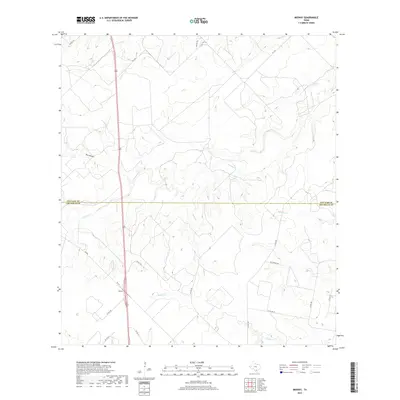
2019 Map of Midway
USGS Topo · Published 2019About this map
Midway serves as a central point in this South Texas landscape where the boundaries of Live Oak and Jim Wells counties meet. The terrain is defined by a dense network of intermittent drainages, including Lagarto Cr, Longoria Cr, and Penitas Cr, which carve through the brush country. The map illustrates a contemporary rural infrastructure where established state routes like FM 624 and FM 3162 intersect with a grid of local county roads and trails such as Yucca Trl and Wild Horse Trl. To the west, the topographic depression of Dix Hollow provides a distinct break in the otherwise steady elevation of the Jim Wells ranchlands. This survey reflects the modern ranching and transit patterns of the region, documenting the spatial relationship between isolated homesteads and the primary transport corridors of the Coastal Bend hinterlands.
Find a feature on this map
22 named features on this map. Tap any name to fly to it.
Don’t see what you’re looking for? This feature index may not catch every label — zoom into the map to look around manually.
Map Details
Editions of this 2019 Midway Map
This is the sole edition of this map. No revisions or reprints were ever made.
Other maps of this area

1920 · Mikeska
USGS Topo · 1:125,000

1920 · San Diego
USGS Topo · 1:62,500

1925 · Mathis No. 2
USGS Topo · 1:48,000

1925 · Mathis No. 3
USGS Topo · 1:48,000

1927 · Mathis
USGS Topo · 1:62,500

1950 · Corpus Christi
USGS Topo · 1:250,000

1953 · Crystal City
USGS Topo · 1:250,000

1953 · Beeville
USGS Topo · 1:250,000

1954 · Orange Grove
USGS Topo · 1:62,500

1954 · Mathis
USGS Topo · 1:62,500