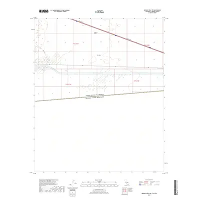
2018 Map of Midway Well NW
USGS Topo · Published 2018About this map
Imperial Valley and the dry expanse of East Mesa define this desert landscape along the international boundary between the United States and Mexico. The All-American Canal cuts a prominent horizontal path across the terrain, serving as a critical piece of water infrastructure for the region's agricultural development. Transportation through this arid environment is facilitated by Evan Hewes Hwy, which runs diagonally across the northern sections, and the smaller Desert Rd. This survey highlights the stark transition between the open mesa and the engineering required to bring water to the valley, providing a clear record of the modern borderlands and the vital hydraulic systems that sustain the local economy.
Find a feature on this map
11 named features on this map. Tap any name to fly to it.
Don’t see what you’re looking for? This feature index may not catch every label — zoom into the map to look around manually.
Map Details
Editions of this 2018 Midway Well NW Map
This is the sole edition of this map. No revisions or reprints were ever made.
Other maps of this area

1907 · Holtville
USGS Topo · 1:125,000

1940 · Alamorio
USGS Topo · 1:62,500

1940 · Calexico
USGS Topo · 1:62,500

1942 · El Centro
USGS Topo · 1:250,000

1943 · Calexico
USGS Topo · 1:62,500

1945 · Alamorio
USGS Topo · 1:62,500
1953 · Calexico
USGS Topo · 1:50,000

1954 · El Centro
USGS Topo · 1:250,000

1954 · Midway Well NW
USGS Topo · 1:24,000
1954 · Glamis SE
USGS Topo · 1:24,000