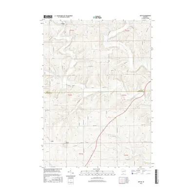
2016 Map of Mifflin
USGS Topo · Published 2016About this map
Mifflin sits at the northern edge of this topographical survey, situated among the upper reaches of the Pecatonica River. The landscape is defined by the winding paths of several tributaries, including Sudan Br and Williams-Rewey Br, which carve through the terrain of Iowa County and Lafayette County. This map documents the rural character of southwestern Wisconsin in the mid-2010s, illustrating how the drainage patterns of the Pecatonica headwaters dictate the local road network and property boundaries. The survey provides a clear look at the intersection of natural watercourses and the established township and range system, offering a precise view of the region's geographic layout before further modern development.
Find a feature on this map
4 named features on this map. Tap any name to fly to it.
Don’t see what you’re looking for? This feature index may not catch every label — zoom into the map to look around manually.
Map Details
Editions of this 2016 Mifflin Map
This is the sole edition of this map. No revisions or reprints were ever made.
Other maps of this area

1902 · Mineral Point
USGS Topo · 1:125,000

1952 · Platteville
USGS Topo · 1:24,000

1952 · Calamine
USGS Topo · 1:24,000

1952 · Rewey
USGS Topo · 1:24,000

1952 · Montfort
USGS Topo · 1:24,000

1952 · Mineral Point
USGS Topo · 1:24,000

1952 · Dodgeville
USGS Topo · 1:24,000

1952 · Belmont
USGS Topo · 1:24,000

1952 · Linden
USGS Topo · 1:24,000

1952 · Mifflin
USGS Topo · 1:24,000