
1937 Map of Mifflintown
USGS Topo · Published 1937About this map
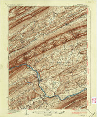
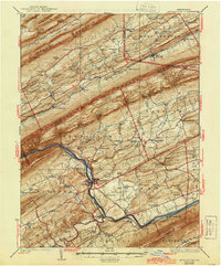
The Juniata River carves a deep path through the ridge-and-valley landscape of central Pennsylvania, anchored by the twin boroughs of Mifflintown and Mifflin. This 1930s survey documents a highly organized rural infrastructure where nearly every valley contains a network of one-room schools such as Whitehall Sch and Jackson Sch, alongside historic congregational centers like Bakers Ch and Brick Ch. The transport corridor is dominated by the Pennsylvania Railroad and the Wm Penn Highway, which follow the river's bend through the Lewistown Narrows. Industrial and agricultural life is evident in the numerous mill sites, including Jericho Mills, Cuba Mills, and Raubs Mills, while the rugged heights of Jacks Mountain and Shade Mountain are punctuated by named gaps and landmarks like the Fire Tower near Mc Cracken Gap.
Find a feature on this map
117 named features on this map. Tap any name to fly to it.
Don’t see what you’re looking for? This feature index may not catch every label — zoom into the map to look around manually.
Map Details
Editions of this 1937 Mifflintown Map
3 editions found
Other maps of this area

1907 · New Bloomfield
USGS Topo · 1:62,500

1907 · Millerstown
USGS Topo · 1:62,500

1919 · Mattawana
USGS Topo · 1:62,500

1924 · Centre Hall
USGS Topo · 1:62,500

1924 · Lewistown
USGS Topo · 1:62,500

1925 · Mifflintown
USGS Topo · 1:48,000

1927 · Lewisburg
USGS Topo · 1:62,500

1929 · Centre Hall
USGS Topo · 1:62,500

1930 · Loysville
USGS Topo · 1:62,500

1933 · Loysville
USGS Topo · 1:62,500