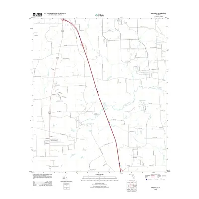
2012 Map of Mikesville
USGS Topo · Published 2012About this map
The Santa Fe River and its subterranean drainage systems define this portion of Columbia County, where the river's path is marked by the unique geology of Natural Bridge and Robinson Sinks. This area, south of the community of Mikesville, is a landscape of karst features and seasonal waterways, including Olustee Cr and Parenners Br. The map documents a rural network of roads and family-named landmarks that reflect generations of local settlement. Several historic burial grounds are preserved across the quadrangle, such as St John Cem in the north and New Hope Cem to the east. The presence of Vinzant Landing along the river and scattered water bodies like Sweet Water Lake and Hogpen Pond suggests a long history of water-dependent land use and early river crossings in this part of northern Florida.
Find a feature on this map
113 named features on this map. Tap any name to fly to it.
Don’t see what you’re looking for? This feature index may not catch every label — zoom into the map to look around manually.
Map Details
Editions of this 2012 Mikesville Map
This is the sole edition of this map. No revisions or reprints were ever made.
Other maps of this area

1954 · Gainesville
USGS Topo · 1:250,000

1954 · Valdosta
USGS Topo · 1:250,000

1958 · Valdosta
USGS Topo · 1:250,000

1958 · Gainesville
USGS Topo · 1:250,000

1959 · Valdosta
USGS Topo · 1:250,000

1959 · Gainesville
USGS Topo · 1:250,000

1962 · High Springs
USGS Topo · 1:24,000

1962 · Mikesville
USGS Topo · 1:24,000

1963 · Ellisville
USGS Topo · 1:24,000

1963 · Columbia
USGS Topo · 1:24,000