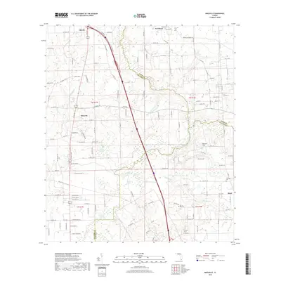
2018 Map of Mikesville
USGS Topo · Published 2018About this map
The Santa Fe River and Olustee Cr define the hydrological character of this northern Florida landscape, where the borders of Columbia, Union, and Alachua counties meet. This modern survey illustrates a rural region centered on Mikesville and Ellisville, showing a transition from the structured wetlands of Buzzard Roost Prairie to the unique karst topography of Robinson Sinks. The map is particularly useful for genealogical research, documenting several local burial grounds including Damascus Cem, New Hope Cem, and St. John Cem. Settlement patterns remain dispersed, following established routes like Co Rd 238 and October Rd, while smaller locales like Providence and Bland anchor the surrounding agricultural and timbered lands. Numerous ponds and branches, such as Ogden Pond and Alligator Br, further detail the intricate drainage systems feeding into the main river channel.
Find a feature on this map
128 named features on this map. Tap any name to fly to it.
Don’t see what you’re looking for? This feature index may not catch every label — zoom into the map to look around manually.
Map Details
Editions of this 2018 Mikesville Map
This is the sole edition of this map. No revisions or reprints were ever made.
Other maps of this area

1954 · Gainesville
USGS Topo · 1:250,000

1954 · Valdosta
USGS Topo · 1:250,000

1958 · Valdosta
USGS Topo · 1:250,000

1958 · Gainesville
USGS Topo · 1:250,000

1959 · Valdosta
USGS Topo · 1:250,000

1959 · Gainesville
USGS Topo · 1:250,000

1962 · High Springs
USGS Topo · 1:24,000

1962 · Mikesville
USGS Topo · 1:24,000

1963 · Ellisville
USGS Topo · 1:24,000

1963 · Columbia
USGS Topo · 1:24,000