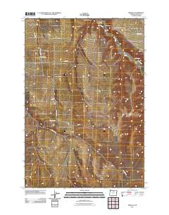
2011 Map of Mikkalo
USGS Topo · Published 2011About this map
Rock Creek winds through this section of the Oregon plateau, providing a central drainage for the surrounding dry canyons and wheat-growing country. The settlement of Mikkalo serves as a focal point in the northwest, featuring the Mikkalo Post Office and the nearby Reed Airstrip. This 2011 survey captures the enduring rural footprint of Gilliam County, where small communities like Clem and Olex are established near their respective burial grounds, Clem Cemetery and Olex Cemetery. The road network, including Clem Mikkalo Rd and Scott Canyon Rd, follows the natural contours of the land, connecting isolated ranching outposts and geographical landmarks like Pats Canyon and Juniper Canyon. Further south, the location of Speece and the crossing at Taylor Bridge reflect the long-standing transport patterns required to navigate this deeply incised landscape.
Find a feature on this map
21 named features on this map. Tap any name to fly to it.
Don’t see what you’re looking for? This feature index may not catch every label — zoom into the map to look around manually.
Map Details
Editions of this 2011 Mikkalo Map
This is the sole edition of this map. No revisions or reprints were ever made.
Other maps of this area

1916 · Arlington
USGS Topo · 1:125,000

1916 · Condon
USGS Topo · 1:125,000

1953 · The Dalles
USGS Topo · 1:250,000

1956 · The Dalles
USGS Topo · 1:250,000

1957 · The Dalles
USGS Topo · 1:250,000

1964 · Turner Butte
USGS Topo · 1:24,000

1964 · Shutler Flat
USGS Topo · 1:24,000

1964 · Hickland Butte
USGS Topo · 1:24,000

1970 · Devils Backbone
USGS Topo · 1:24,000
1970 · Wolf Hollow Falls
USGS Topo · 1:24,000