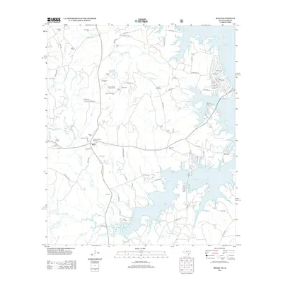
2012 Map of Milam
USGS Topo · Published 2012About this map
The Toledo Bend Reservoir dominates the eastern landscape of this Sabine County region, where the winding inlets and submerged creek beds of the Palo Gaucho Bayou meet the Texas-Louisiana border. Near the settlement of Milam, the map reveals a dense network of family and community burial grounds, including the Low's Chapel Cem and Oliphant Memorial Cem. These sites, along with smaller plots like the Cannon Family Cem and Evans Family Cem, provide a detailed genealogical record of the families who settled this timber-rich country.
Find a feature on this map
81 named features on this map. Tap any name to fly to it.
Don’t see what you’re looking for? This feature index may not catch every label — zoom into the map to look around manually.
Map Details
Editions of this 2012 Milam Map
This is the sole edition of this map. No revisions or reprints were ever made.
Other maps of this area

1941 · Zwolle
USGS Topo · 1:62,500

1944 · Negreet
USGS Topo · 1:62,500

1944 · Patroon
USGS Topo · 1:62,500

1944 · Zwolle
USGS Topo · 1:62,500

1953 · Alexandria
USGS Topo · 1:250,000

1954 · Columbus
USGS Topo · 1:24,000

1954 · Negreet
USGS Topo · 1:62,500

1954 · Salter Creek
USGS Topo · 1:24,000

1955 · Alexandria
USGS Topo · 1:250,000

1956 · Patroon
USGS Topo · 1:62,500