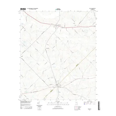
2014 Map of Milan
USGS Topo · Published 2014About this map
Milan and Chauncey anchor this survey of south-central Georgia, where the boundary between Dodge and Telfair counties cuts diagonally through a landscape of creek bottoms and rural crossings. The transport network follows a distinct pattern, with Ga-27 and the parallel rail corridor connecting smaller communities like McCranie and Ararat. This 2014 edition documents the long-standing agricultural and residential layout of the region, emphasizing the importance of family and community landmarks like Hamilton Cemetery and Antioch Cemetery.
Find a feature on this map
74 named features on this map. Tap any name to fly to it.
Don’t see what you’re looking for? This feature index may not catch every label — zoom into the map to look around manually.
Map Details
Editions of this 2014 Milan Map
This is the sole edition of this map. No revisions or reprints were ever made.
Other maps of this area

1953 · Waycross
USGS Topo · 1:250,000

1957 · Macon
USGS Topo · 1:250,000

1958 · Macon
USGS Topo · 1:250,000

1958 · Waycross
USGS Topo · 1:250,000

1964 · Macon
USGS Topo · 1:250,000

1972 · Eastman
USGS Topo · 1:24,000

1972 · Cooks Still
USGS Topo · 1:24,000

1972 · Mc Rae NW
USGS Topo · 1:24,000

1972 · Jay Bird Springs
USGS Topo · 1:24,000
1972 · Milan
USGS Topo · 1:24,000