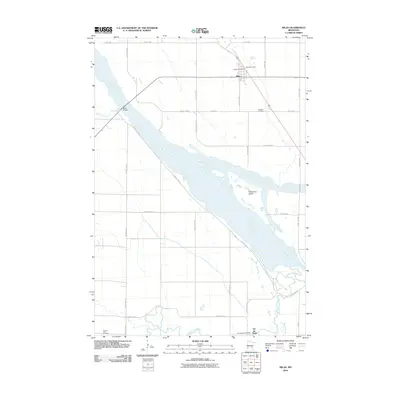
2010 Map of Milan
USGS Topo · Published 2010About this map
The Minnesota River and the low-lying basin of the Watson Sag dominate this landscape in western Chippewa County. The settlement of Milan sits at the northern edge of this complex hydrologic network, serving as a hub where the Milan Post Office and Milan Rest Area provide infrastructure for travelers and residents alike. The river valley's physical geography is defined by broad channels and landforms like Rosemoen Island, where the water transitions toward the Lac qui Parle River to the south.
Find a feature on this map
31 named features on this map. Tap any name to fly to it.
Don’t see what you’re looking for? This feature index may not catch every label — zoom into the map to look around manually.
Map Details
Editions of this 2010 Milan Map
This is the sole edition of this map. No revisions or reprints were ever made.
Other maps of this area

1953 · Milbank
USGS Topo · 1:250,000

1953 · Watertown
USGS Topo · 1:250,000

1953 · New Ulm
USGS Topo · 1:250,000

1953 · Saint Cloud
USGS Topo · 1:250,000

1957 · Saint Cloud
USGS Topo · 1:250,000

1957 · New Ulm
USGS Topo · 1:250,000

1958 · New Ulm
USGS Topo · 1:250,000

1958 · Milbank
USGS Topo · 1:250,000

1958 · Watertown
USGS Topo · 1:250,000

1958 · Saint Cloud
USGS Topo · 1:250,000